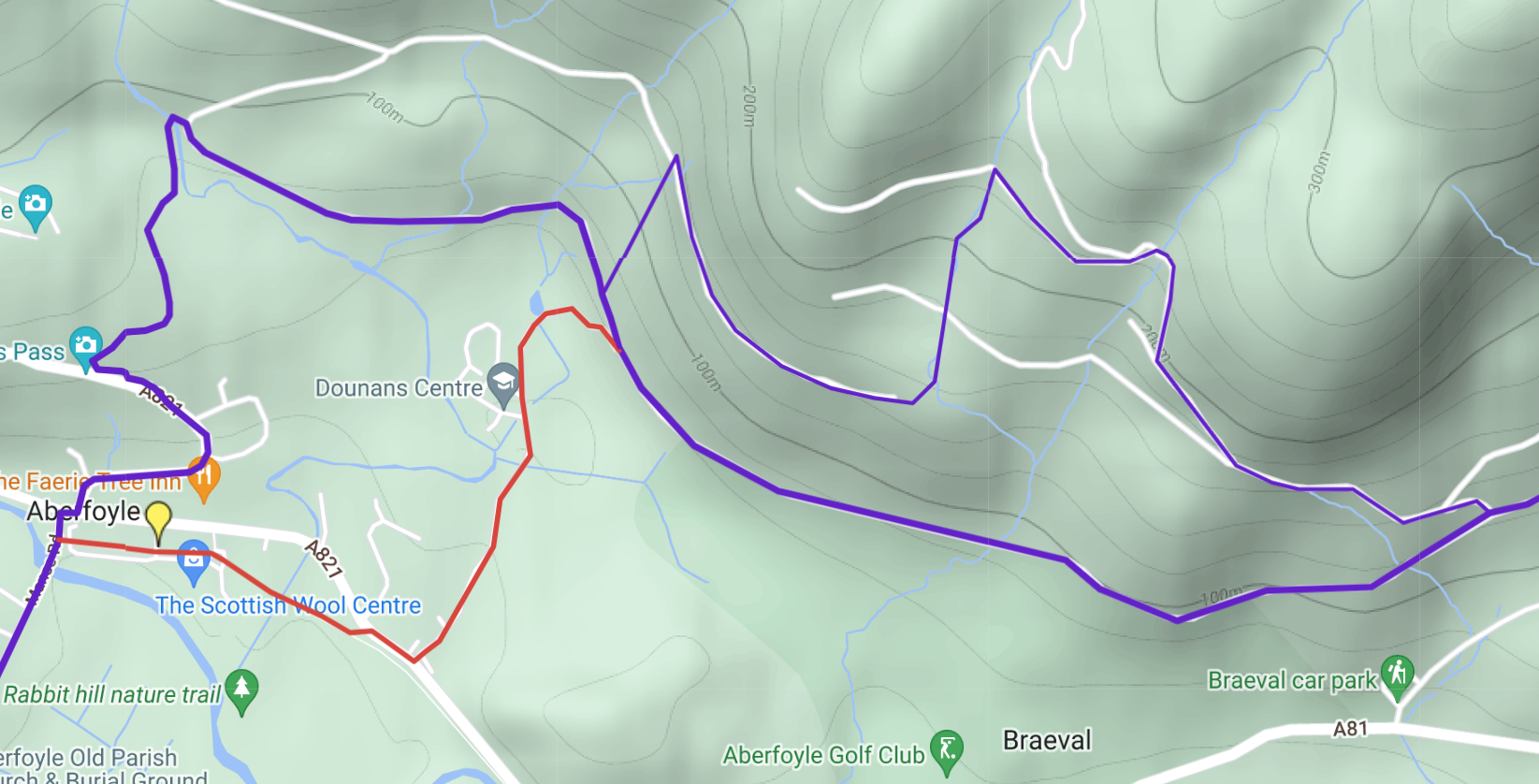
Route out of Aberfoyle (updated 1 July and 7 Oct 2024)
Timber harvesting and extraction near Braeval was completed in late June and as of 1 July 2024 the main Way has reopened fully and all diversion signage has been removed.
From 16 May a section of route north of Braeval (east of Dounans) was closed because of statutory felling of diseased larch trees. The felling was on weekdays only. Happily the detour adds only 1 km to the length overall: we show it as a thinner purple line to the north of the existing one on our map. We are told it will be clearly signed. On weekends, the original route can still be followed. Update: this work finished in August/September.
Until the unsafe footbridge inside the forest near Aberfoyle has been replaced (update: expected 14 October), walkers and cyclists should revert to the original RRW route (unless at your own risk you are happy to cross the stream on informal stepping stones as most people seem to be doing). The original route was shorter: from Manse Road, turn right (south-east) through Aberfoyle’s car park to follow Cycle Route 7 on railway trackbed. After 250 m bear left at a grassy triangle and turn right at the main road. Soon turn left up past Dounans Outdoor Centre and join the forest road at mile 11.9. This route is shown in red on our online route map. For more detail, see our post of 8 Nov 2023.